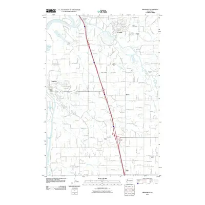
2011 Map of Ridgefield
USGS Topo · Published 2011About this map
La Center and Ridgefield anchor this 2011 perspective on the Clark County landscape, where the East Fork Lewis River and Lake River define the local hydrology. The map details a transition from the river-fed lowlands containing Campbell Lake and Quigley Lake to the more structured transportation corridor of I-5. This modern survey is particularly useful for genealogists and local historians, as it meticulously identifies long-standing civic landmarks such as Mount Zion Cemetery, Pioneer Cemetery, and the Good Hope School. The placement of the Ridgefield Post Office and several small dams, including Buckbee Dam and Hiim Reservoir Dam, provides a clear view of the infrastructure supporting these communities. Smaller settlements like West Pioneer, Lambert, and Paradise Point are documented alongside natural features like Allen Canyon, illustrating how the region's geography has shaped its development.
Find a feature on this map
38 named features on this map. Tap any name to fly to it.
Don’t see what you’re looking for? This feature index may not catch every label — zoom into the map to look around manually.
Map Details
Editions of this 2011 Ridgefield Map
This is the sole edition of this map. No revisions or reprints were ever made.
Other maps of this area

1897 · Portland
USGS Topo · 1:62,500

1905 · Portland
USGS Topo · 1:62,500

1915 · Hillsboro
USGS Topo · 1:62,500

1918 · Hillsboro
USGS Topo · 1:62,500

1922 · St. Helens
USGS Topo · 1:62,500

1940 · Hillsboro
USGS Topo · 1:62,500

1940 · Portland
USGS Topo · 1:62,500

1940 · La Center
USGS Topo · 1:62,500

1941 · St Helens
USGS Topo · 1:62,500

1943 · St Helens
USGS Topo · 1:62,500