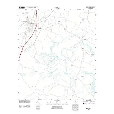
2011 Map of Ridgeland
USGS Topo · Published 2011About this map
Ridgeland and its neighboring Lowcountry communities are captured here in a transition between their historic rural roots and modern accessibility. The settlement pattern shows a concentration of activity along the corridor where Interstate 95 and Highway 17 intersect, while older hamlets like Grahamville and Old House maintain their distinct geographic identities. The map provides significant detail for genealogists, documenting a high density of burial grounds including Grahamville Cemetery, Wrightfield Cemetery, and the remote Partridge Hill Cemetery near the northern border.
Find a feature on this map
56 named features on this map. Tap any name to fly to it.
Don’t see what you’re looking for? This feature index may not catch every label — zoom into the map to look around manually.
Map Details
Editions of this 2011 Ridgeland Map
This is the sole edition of this map. No revisions or reprints were ever made.
Other maps of this area

1918 · Yemassee
USGS Topo · 1:62,500

1919 · Pineland
USGS Topo · 1:62,500

1920 · Hardeeville
USGS Topo · 1:62,500

1920 · Okatie
USGS Topo · 1:62,500

1942 · Okatie
USGS Topo · 1:62,500

1943 · Pineland
USGS Topo · 1:62,500

1943 · Hardeeville
USGS Topo · 1:62,500

1943 · Yemassee
USGS Topo · 1:62,500

1947 · Savannah
USGS Topo · 1:250,000

1948 · Savannah
USGS Topo · 1:250,000