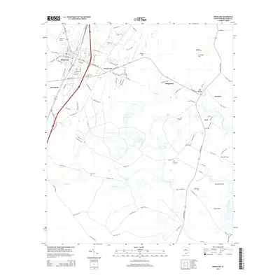
2014 Map of Ridgeland
USGS Topo · Published 2014About this map
Ridgeland serves as the focal point of this Lowcountry landscape, where the intersection of Gray's Hwy and N Jacob Smart Blvd marks the town's central commercial and residential core. This survey captures a network of rural communities including Grahamville and Mitchellville, which are defined by their proximity to historical family-named cemeteries such as Grahamville Cem and Berton Cem. The terrain is characterized by subtle elevation changes at Honey Hill and Partridge Hill, with the hydrology dominated by the meandering paths of Euhaw Creek and Hazzard Creek.
Find a feature on this map
96 named features on this map. Tap any name to fly to it.
Don’t see what you’re looking for? This feature index may not catch every label — zoom into the map to look around manually.
Map Details
Editions of this 2014 Ridgeland Map
This is the sole edition of this map. No revisions or reprints were ever made.
Other maps of this area

1918 · Yemassee
USGS Topo · 1:62,500

1919 · Pineland
USGS Topo · 1:62,500

1920 · Hardeeville
USGS Topo · 1:62,500

1920 · Okatie
USGS Topo · 1:62,500

1942 · Okatie
USGS Topo · 1:62,500

1943 · Pineland
USGS Topo · 1:62,500

1943 · Hardeeville
USGS Topo · 1:62,500

1943 · Yemassee
USGS Topo · 1:62,500

1947 · Savannah
USGS Topo · 1:250,000

1948 · Savannah
USGS Topo · 1:250,000