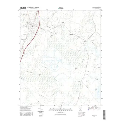
2017 Map of Ridgeland
USGS Topo · Published 2017About this map
The Lowcountry landscape of Jasper County is defined by its intricate network of blackwater creeks and wetlands, where Honey Hill Swamp and Euhaw Cr navigate a terrain of low rises and points. Small, established settlements like Grahamville and Old House are situated along the primary corridors of N Jacob Smart Blvd and Lowcountry Dr, reflecting the area's rural residential character. The presence of several family and community burial grounds, including Grahamville Cem, Partridge Hill Cem, and Wrightfield Cem, provides valuable points of reference for genealogists tracing local families.
Find a feature on this map
69 named features on this map. Tap any name to fly to it.
Don’t see what you’re looking for? This feature index may not catch every label — zoom into the map to look around manually.
Map Details
Editions of this 2017 Ridgeland Map
This is the sole edition of this map. No revisions or reprints were ever made.
Other maps of this area

1918 · Yemassee
USGS Topo · 1:62,500

1919 · Pineland
USGS Topo · 1:62,500

1920 · Hardeeville
USGS Topo · 1:62,500

1920 · Okatie
USGS Topo · 1:62,500

1942 · Okatie
USGS Topo · 1:62,500

1943 · Pineland
USGS Topo · 1:62,500

1943 · Hardeeville
USGS Topo · 1:62,500

1943 · Yemassee
USGS Topo · 1:62,500

1947 · Savannah
USGS Topo · 1:250,000

1948 · Savannah
USGS Topo · 1:250,000