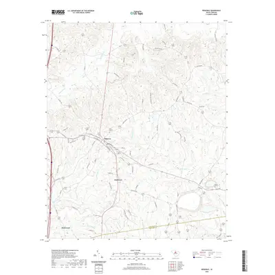
2020 Map of Ridgeway
USGS Topo · Published 2020About this map
Ridgeway sits at the heart of this Piedmont landscape, serving as a focal point for a network of rural roads and historical markers. To the south, the settlement of Smallwood and the northern edge of Blythewood illustrate the residential expansion moving across the Fairfield Co Richland Co line. The terrain is deeply carved by a dense hydrological system, with Twentyfive Mile Cr and Sawneys Cr draining the eastern slopes. Genealogists will find several notable burial grounds, including Saint Stephens Cem and Aimwell Cem near the town center, and the more secluded Sawneys Creek Cem to the east. The presence of Old Camden Rd and various family-named routes like Mood Harrison Rd reflect the enduring local infrastructure that connects these communities across the ridges and creek valleys of the South Carolina interior.
Find a feature on this map
76 named features on this map. Tap any name to fly to it.
Don’t see what you’re looking for? This feature index may not catch every label — zoom into the map to look around manually.
Map Details
Editions of this 2020 Ridgeway Map
This is the sole edition of this map. No revisions or reprints were ever made.
Other maps of this area

1904 · Columbia
USGS Topo · 1:125,000

1935 · Killian
USGS Topo · 1:48,000

1937 · Killian
USGS Topo · 1:62,500

1941 · Spartanburg
USGS Topo · 1:250,000

1942 · Camden
USGS Topo · 1:125,000

1949 · Irmo NE
USGS Topo · 1:24,000

1953 · Blythewood
USGS Topo · 1:24,000

1953 · Blaney
USGS Topo · 1:24,000

1953 · Spartanburg
USGS Topo · 1:250,000

1960 · Spartanburg
USGS Topo · 1:250,000