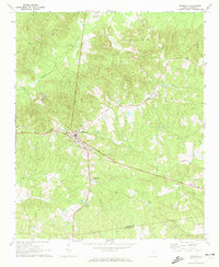
1971 Map of Ridgeway
USGS Topo · Published 1972About this map
Ridgeway serves as the central hub of this Fairfield County landscape, situated at the junction of the Southern railroad and several primary roads. The settlement's layout is clearly defined, with St Stephens Ch and the Aimwell Cem marking the community's core during the early 1970s. The surrounding terrain is heavily dissected by a dense network of watercourses, including Dutchmans Creek, Sawneys Creek, and Twentyfive Mile Creek, which create a complex system of ridges and valleys.
Find a feature on this map
25 named features on this map. Tap any name to fly to it.
Don’t see what you’re looking for? This feature index may not catch every label — zoom into the map to look around manually.
Map Details
Editions of this 1971 Ridgeway Map
This is the sole edition of this map. No revisions or reprints were ever made.
Other maps of this area

1904 · Columbia
USGS Topo · 1:125,000

1935 · Killian
USGS Topo · 1:48,000

1937 · Killian
USGS Topo · 1:62,500

1941 · Spartanburg
USGS Topo · 1:250,000

1942 · Camden
USGS Topo · 1:125,000

1949 · Irmo NE
USGS Topo · 1:24,000

1953 · Blythewood
USGS Topo · 1:24,000

1953 · Blaney
USGS Topo · 1:24,000

1953 · Spartanburg
USGS Topo · 1:250,000

1960 · Spartanburg
USGS Topo · 1:250,000