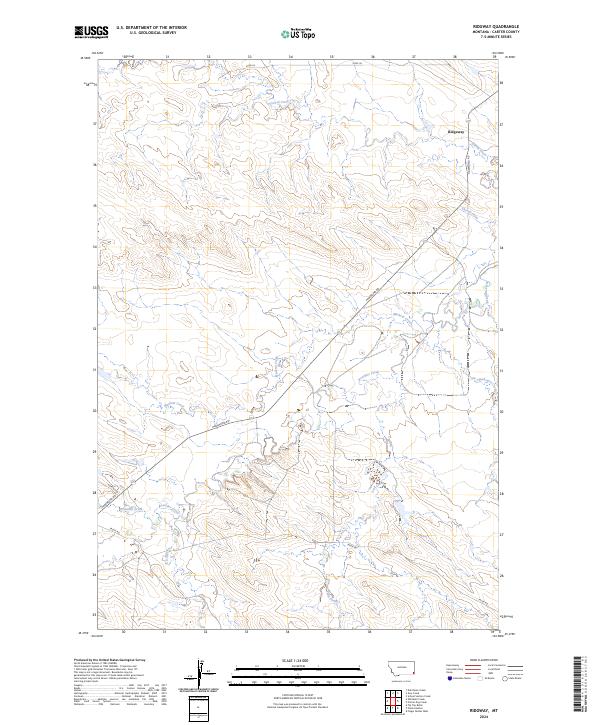
2024 Map of Ridgway
USGS Topo · Published 2024About this map
Ridgeway anchors this remote section of Carter County, characterized by a complex network of seasonal drainages and local ranch roads. The landscape is defined by the branching tributaries of Boxelder Creek and Muskrat Creek, which carve through the high plains. Local transit relies on established routes such as Hammond Rd, which cuts diagonally across the center of the quadrangle, and Tauck Rd in the southern reaches. These roads provide the primary lifelines between isolated homesteads and the broader regional network.
Find a feature on this map
17 named features on this map. Tap any name to fly to it.
Don’t see what you’re looking for? This feature index may not catch every label — zoom into the map to look around manually.
Map Details
Editions of this 2024 Ridgway Map
This is the sole edition of this map. No revisions or reprints were ever made.
Other maps of this area

1954 · Ekalaka
USGS Topo · 1:250,000

1956 · Ekalaka
USGS Topo · 1:250,000

1958 · Ekalaka
USGS Topo · 1:250,000

1965 · Ekalaka
USGS Topo · 1:250,000

1979 · Dutchman Creek
USGS Topo · 1:24,000

1979 · Ikey Creek
USGS Topo · 1:24,000

1980 · Prairie Dog Creek
USGS Topo · 1:24,000
1980 · School Section Creek
USGS Topo · 1:24,000
1980 · Finger Buttes West
USGS Topo · 1:24,000

1981 · Alzada
USGS Topo · 1:100,000