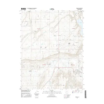
2016 Map of Ridgway
USGS Topo · Published 2016About this map
Ridgway sits at the eastern edge of this landscape, positioned along the Uncompahgre River where Dallas Creek joins the main flow. The terrain is defined by a series of dramatic geographic benches, including Log Hill Mesa, Burnt Mill Mesa, and Miller Mesa, which overlook the Pleasant Valley corridor. In the north, the Ridgway Reservoir fills the valley floor beneath the Enchanted Mesa and the edge of the Uncompahgre Plateau.
Find a feature on this map
113 named features on this map. Tap any name to fly to it.
Don’t see what you’re looking for? This feature index may not catch every label — zoom into the map to look around manually.
Map Details
Editions of this 2016 Ridgway Map
This is the sole edition of this map. No revisions or reprints were ever made.
Other maps of this area

1902 · Ouray
USGS Topo · 1:62,500

1904 · Ouray
USGS Topo · 1:62,500

1909 · Montrose
USGS Topo · 1:125,000

1911 · Montrose
USGS Topo · 1:125,000

1955 · Ouray
USGS Topo · 1:24,000

1956 · Montrose
USGS Topo · 1:250,000

1959 · Montrose
USGS Topo · 1:250,000

1960 · Montrose
USGS Topo · 1:250,000
1963 · Buckhorn Lakes
USGS Topo · 1:24,000
1963 · Dallas
USGS Topo · 1:24,000