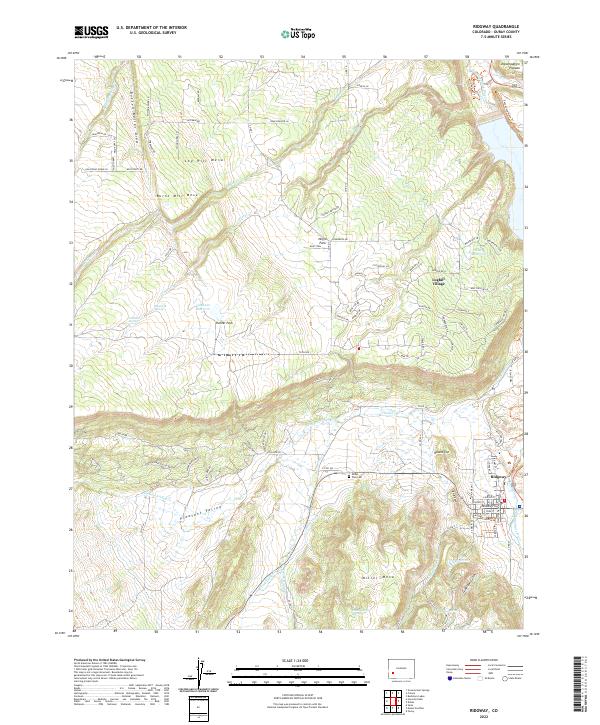
2022 Map of Ridgway
USGS Topo · Published 2022About this map
The Uncompahgre River flows through the eastern edge of this terrain, where the settlement of Ridgway serves as a local hub. The landscape is defined by a series of distinct mesas and canyons, including Log Hill Mesa, Burnt Mill Mesa, and Miller Mesa. These elevated flats are cut by drainages such as Dallas Cr and Pleasant Valley Cr, creating a complex network of ridges like the Knife Edge and draws such as Busted Boiler Draw.
Find a feature on this map
97 named features on this map. Tap any name to fly to it.
Don’t see what you’re looking for? This feature index may not catch every label — zoom into the map to look around manually.
Map Details
Editions of this 2022 Ridgway Map
This is the sole edition of this map. No revisions or reprints were ever made.
Other maps of this area

1902 · Ouray
USGS Topo · 1:62,500

1904 · Ouray
USGS Topo · 1:62,500

1909 · Montrose
USGS Topo · 1:125,000

1911 · Montrose
USGS Topo · 1:125,000

1955 · Ouray
USGS Topo · 1:24,000

1956 · Montrose
USGS Topo · 1:250,000

1959 · Montrose
USGS Topo · 1:250,000

1960 · Montrose
USGS Topo · 1:250,000
1963 · Buckhorn Lakes
USGS Topo · 1:24,000
1963 · Dallas
USGS Topo · 1:24,000