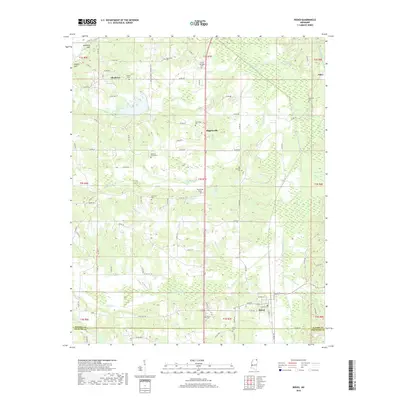
2018 Map of Rienzi
USGS Topo · Published 2018About this map
Rienzi and the surrounding borderlands of Alcorn and Prentiss counties are defined by a complex drainage network feeding into the Tuscumbia River. This landscape is marked by numerous family and community landmarks, including the Dilworth Cemeteries, Wheeler Cem, and the historically significant Tuscumbias Grave near Mitchel Lake. The settlement pattern follows the high ground between creek branches like Bynum Cr and Hinkle Cr, where small clusters such as Allentown and Biggersville took root. The presence of the Old Danville Cem and Stockade Cem suggests layers of local history tied to early Mississippi frontier life and the development of the rural rail-and-road corridor that still connects these communities. The topography transitions from the elevations of Kimmons Hill to the wetland margins of Santa Fe Lake and the Railroad Br area, illustrating how the natural hydrology shaped the placement of farms and cemeteries alike.
Find a feature on this map
99 named features on this map. Tap any name to fly to it.
Don’t see what you’re looking for? This feature index may not catch every label — zoom into the map to look around manually.
Map Details
Editions of this 2018 Rienzi Map
This is the sole edition of this map. No revisions or reprints were ever made.
Other maps of this area

1921 · Booneville
USGS Topo · 1:48,000

1922 · Booneville
USGS Topo · 1:62,500

1935 · Glens
USGS Topo · 1:24,000

1936 · Kendrick
USGS Topo · 1:24,000

1950 · Corinth
USGS Topo · 1:62,500

1950 · Kendrick
USGS Topo · 1:24,000

1950 · Glens
USGS Topo · 1:24,000

1950 · Altitude
USGS Topo · 1:24,000

1956 · Tupelo
USGS Topo · 1:250,000

1958 · Tupelo
USGS Topo · 1:250,000