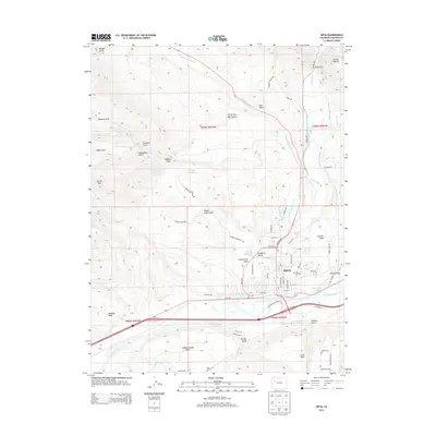
2013 Map of Rifle
USGS Topo · Published 2013About this map
Rifle stands as the central hub of this landscape, situated where Rifle Creek flows into the Colorado River. The town's grid is well-established by this era, anchored by Railroad Ave and containing the Rose Hill Cem to the east. The surrounding geography is defined by a series of prominent elevated benches and canyons, including Hubbard Mesa, Prefontaine Mesa, and the distinctive Grand Hogback ridge to the northeast. Water management is a primary feature of the region's development, evidenced by an intricate network of irrigation channels like the Pioneer Ditch, Davie Ditch, and Grand Tunnel Ditch that traverse the arid terrain to support local life. Smaller settlements such as Lacy and Cactus Valley occupy the river valley, while the higher elevations are marked by remote landmarks like Devils Park and Goodrich Park.
Find a feature on this map
76 named features on this map. Tap any name to fly to it.
Don’t see what you’re looking for? This feature index may not catch every label — zoom into the map to look around manually.
Map Details
Editions of this 2013 Rifle Map
This is the sole edition of this map. No revisions or reprints were ever made.
Other maps of this area

1906 · Grand Hogback
USGS Topo · 1:125,000

1910 · Grand Hogback
USGS Topo · 1:125,000

1952 · Rio Blanco
USGS Topo · 1:24,000

1952 · Anvil Points
USGS Topo · 1:24,000

1952 · Horse Mountain
USGS Topo · 1:24,000

1952 · Rifle
USGS Topo · 1:24,000

1957 · Leadville
USGS Topo · 1:250,000

1959 · Leadville
USGS Topo · 1:250,000

1960 · Leadville
USGS Topo · 1:250,000

1960 · North Mamm Peak
USGS Topo · 1:24,000