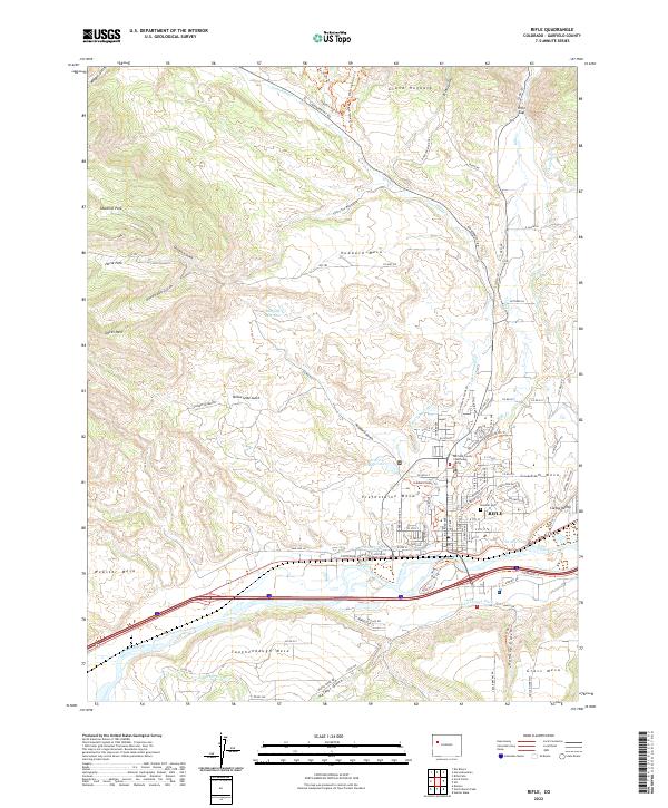
2022 Map of Rifle
USGS Topo · Published 2022About this map
Rifle serves as the central hub of this Colorado landscape, situated where the Colorado River and the Union Pacific RR corridor navigate the valley floor. The map illustrates a complex network of agricultural and industrial water management, featuring named infrastructure like the Pioneer Ditch, Last Chance Ditch, and Murphy Reservoir. These systems support the various mesas flanking the town, including Graham Mesa and Prefontaine Mesa, where residential expansion meets the historical roots of the region.
Find a feature on this map
96 named features on this map. Tap any name to fly to it.
Don’t see what you’re looking for? This feature index may not catch every label — zoom into the map to look around manually.
Map Details
Editions of this 2022 Rifle Map
This is the sole edition of this map. No revisions or reprints were ever made.
Other maps of this area

1906 · Grand Hogback
USGS Topo · 1:125,000

1910 · Grand Hogback
USGS Topo · 1:125,000

1952 · Rio Blanco
USGS Topo · 1:24,000

1952 · Anvil Points
USGS Topo · 1:24,000

1952 · Horse Mountain
USGS Topo · 1:24,000

1952 · Rifle
USGS Topo · 1:24,000

1957 · Leadville
USGS Topo · 1:250,000

1959 · Leadville
USGS Topo · 1:250,000

1960 · Leadville
USGS Topo · 1:250,000

1960 · North Mamm Peak
USGS Topo · 1:24,000