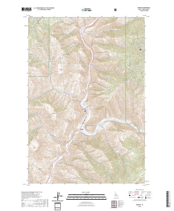
2024 Map of Riggins
USGS Topo · Published 2024About this map
Riggins occupies the narrow canyon floor where the Little Salmon River joins the main Salmon River, serving as a central hub for this vertical landscape. The settlement is hemmed in by steep slopes leading to landmarks like Schoolmarm Peak and Preacher Mtn, reflecting the constrained geography of this river-front community. Local history is anchored at the Riggins Cem on the northern edge of town, while the surrounding Nez Perce National Forest is marked by a network of forest development roads and family-named terrain features such as McCanen Gulch and Egbert Gulch.
Find a feature on this map
56 named features on this map. Tap any name to fly to it.
Don’t see what you’re looking for? This feature index may not catch every label — zoom into the map to look around manually.
Map Details
Editions of this 2024 Riggins Map
This is the sole edition of this map. No revisions or reprints were ever made.
Other maps of this area

1938 · Riggins
USGS Topo · 1:96,000

1945 · Riggins
USGS Topo · 1:125,000

1955 · Grangeville
USGS Topo · 1:250,000

1959 · Grangeville
USGS Topo · 1:250,000

1963 · John Day Mtn
USGS Topo · 1:24,000

1963 · Lucile
USGS Topo · 1:24,000

1963 · Kirkwood Creek
USGS Topo · 1:24,000
1964 · Patrick Butte
USGS Topo · 1:24,000

1964 · Riggins
USGS Topo · 1:24,000
1964 · Pollock
USGS Topo · 1:24,000