
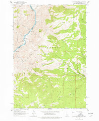
1963 Map of Kirkwood Creek
USGS Topo · Published 1965About this map
The Snake River carves a deep path through this borderland of Idaho and Wallowa counties, revealing a landscape defined by dramatic elevation changes and seasonal ranching activity. Notable for its riverine features, the map documents a series of white-water challenges including Durham Rapids, China Rapids, and the Upper Kirby Rapids. Human presence in this steep terrain is marked by remote outposts such as Dixon Cow Camp and Kirkwood Cow Camp, reflecting the region's history of high-country grazing within the Nezperce National Forest and Wallowa National Forest.
Find a feature on this map
54 named features on this map. Tap any name to fly to it.
Don’t see what you’re looking for? This feature index may not catch every label — zoom into the map to look around manually.
Map Details
Editions of this 1963 Kirkwood Creek Map
2 editions found
Other maps of this area

1922 · He Devil
USGS Topo · 1:48,000

1938 · Riggins
USGS Topo · 1:96,000

1945 · Riggins
USGS Topo · 1:125,000

1954 · Kernan Point
USGS Topo · 1:62,500

1955 · Grangeville
USGS Topo · 1:250,000

1957 · He Devil
USGS Topo · 1:62,500

1959 · Grangeville
USGS Topo · 1:250,000

1963 · Lucile
USGS Topo · 1:24,000

1963 · Slate Creek
USGS Topo · 1:24,000

1963 · Grave Point
USGS Topo · 1:24,000