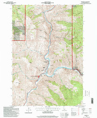
1995 Map of Riggins
USGS Topo · Published 1999About this map
The Salmon River and Little Salmon River meet at the heart of this Idaho canyon landscape, where the town of Riggins serves as a gateway to the surrounding backcountry. This mid-1990s survey illustrates the concentration of community life along the riverbanks, featuring North Riggins, the North Riggins Cemetery, and the Salmon River High School. The geography is defined by steep drainages like Race Creek and Shorts Creek that feed into the main river corridor, providing a clear look at the region's complex verticality before the modernization of the new millennium.
Find a feature on this map
42 named features on this map. Tap any name to fly to it.
Don’t see what you’re looking for? This feature index may not catch every label — zoom into the map to look around manually.
Map Details
Editions of this 1995 Riggins Map
This is the sole edition of this map. No revisions or reprints were ever made.
Other maps of this area

1938 · Riggins
USGS Topo · 1:96,000

1945 · Riggins
USGS Topo · 1:125,000

1955 · Grangeville
USGS Topo · 1:250,000

1959 · Grangeville
USGS Topo · 1:250,000

1963 · John Day Mtn
USGS Topo · 1:24,000

1963 · Lucile
USGS Topo · 1:24,000

1963 · Kirkwood Creek
USGS Topo · 1:24,000
1964 · Patrick Butte
USGS Topo · 1:24,000

1964 · Riggins
USGS Topo · 1:24,000
1964 · Pollock
USGS Topo · 1:24,000