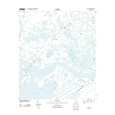
2012 Map of Rigolets
USGS Topo · Published 2012About this map
Fort Pike State Historic Site stands as a primary landmark at the narrow passage where Lake Pontchartrain meets The Rigolets, guarding the historic water route toward New Orleans. This coastal landscape is a complex network of brackish lagoons and marshland, defined by features like Double Bayou Lagoon and Goose Pond. The presence of the Rigolets Seaplane Base near Rabbit Island and the proximity of the Intracoastal Waterway highlights the area's continued reliance on marine and aerial navigation.
Find a feature on this map
78 named features on this map. Tap any name to fly to it.
Don’t see what you’re looking for? This feature index may not catch every label — zoom into the map to look around manually.
Map Details
Editions of this 2012 Rigolets Map
This is the sole edition of this map. No revisions or reprints were ever made.
Other maps of this area

1892 · Chef Menteur
USGS Topo · 1:62,500

1893 · Rigolets
USGS Topo · 1:62,500

1914 · Nicholson
USGS Topo · 1:62,500

1921 · Nicholson
USGS Topo · 1:62,500

1935 · Slidell
USGS Topo · 1:62,500

1935 · English Lookout
USGS Topo · 1:31,680

1936 · North Shore
USGS Topo · 1:31,680

1936 · Chef Menteur
USGS Topo · 1:62,500

1936 · Rigolets
USGS Topo · 1:62,500

1937 · Chef Menteur
USGS Topo · 1:31,680