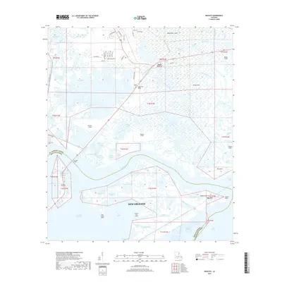
2018 Map of Rigolets
USGS Topo · Published 2018About this map
The Rigolets provides the central aquatic corridor of this coastal Louisiana landscape, connecting Lake Pontchartrain toward the Gulf. The area is dominated by an intricate network of marshes and islands, including the prominent Honey Island and Weems Island, where the West Pearl River and West Mouth meet the tidal complex. Small settlements like White Kitchen and Rigolets sit along the primary transit corridors that bridge these waterways.
Find a feature on this map
88 named features on this map. Tap any name to fly to it.
Don’t see what you’re looking for? This feature index may not catch every label — zoom into the map to look around manually.
Map Details
Editions of this 2018 Rigolets Map
This is the sole edition of this map. No revisions or reprints were ever made.
Other maps of this area

1892 · Chef Menteur
USGS Topo · 1:62,500

1893 · Rigolets
USGS Topo · 1:62,500

1914 · Nicholson
USGS Topo · 1:62,500

1921 · Nicholson
USGS Topo · 1:62,500

1935 · Slidell
USGS Topo · 1:62,500

1935 · English Lookout
USGS Topo · 1:31,680

1936 · North Shore
USGS Topo · 1:31,680

1936 · Chef Menteur
USGS Topo · 1:62,500

1936 · Rigolets
USGS Topo · 1:62,500

1937 · Chef Menteur
USGS Topo · 1:31,680