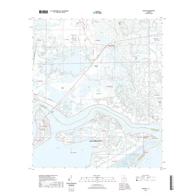
2020 Map of Rigolets
USGS Topo · Published 2020About this map
The deltaic landscape of the West Pearl River and The Rigolets dominates this coastal Louisiana survey, where intricate waterways meet the expansive Lake Saint Catherine. Along the northern edge of New Orleans, the map reveals a complex environment of marshes and ridges, including the appropriately named Apple Pie Ridge and the settlement of White Kitchen. This area is a critical junction for maritime and land travel, evidenced by the presence of the Intracoastal Waterway and the Fort Pike Bridge, which spans the deep channel connecting Lake Borgne to the interior basins.
Find a feature on this map
89 named features on this map. Tap any name to fly to it.
Don’t see what you’re looking for? This feature index may not catch every label — zoom into the map to look around manually.
Map Details
Editions of this 2020 Rigolets Map
This is the sole edition of this map. No revisions or reprints were ever made.
Other maps of this area

1892 · Chef Menteur
USGS Topo · 1:62,500

1893 · Rigolets
USGS Topo · 1:62,500

1914 · Nicholson
USGS Topo · 1:62,500

1921 · Nicholson
USGS Topo · 1:62,500

1935 · Slidell
USGS Topo · 1:62,500

1935 · English Lookout
USGS Topo · 1:31,680

1936 · North Shore
USGS Topo · 1:31,680

1936 · Chef Menteur
USGS Topo · 1:62,500

1936 · Rigolets
USGS Topo · 1:62,500

1937 · Chef Menteur
USGS Topo · 1:31,680