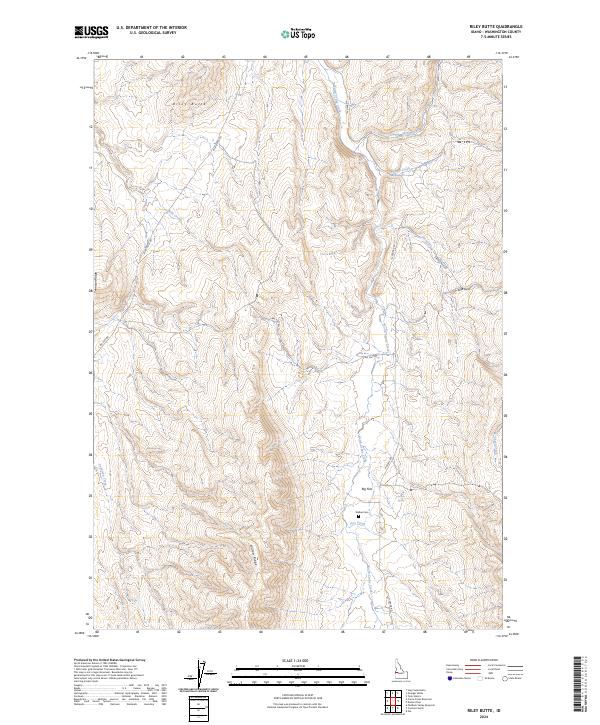
2024 Map of Riley Butte
USGS Topo · Published 2024About this map
Riley Butte rises as a prominent landmark in this upland portion of Washington County, overlooking a landscape defined by sharp ridges and deep creek drainages. The topography is anchored by Tennison Ridge to the west and the expansive Big Flat plateau to the south, with the terrain falling away into the headwaters of North Crane Creek and Sheep Creek. This contemporary survey reflects the remote ranching and grazing character of the region, where access is dictated by primitive routes like Riley Butte Rd and Big Flat Rd.
Find a feature on this map
22 named features on this map. Tap any name to fly to it.
Don’t see what you’re looking for? This feature index may not catch every label — zoom into the map to look around manually.
Map Details
Editions of this 2024 Riley Butte Map
This is the sole edition of this map. No revisions or reprints were ever made.
Other maps of this area

1894 · Squaw Creek
USGS Topo · 1:125,000

1897 · Weiser
USGS Topo · 1:125,000

1955 · Baker
USGS Topo · 1:250,000

1957 · Crane Creek Reservoir
USGS Topo · 1:62,500

1959 · Baker
USGS Topo · 1:250,000

1970 · Dodson Pass
USGS Topo · 1:24,000
1970 · Paddock Valley Reservoir
USGS Topo · 1:24,000
1970 · Coonrod Gulch
USGS Topo · 1:24,000

1970 · Granger Butte
USGS Topo · 1:24,000
1970 · Ola
USGS Topo · 1:24,000