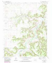
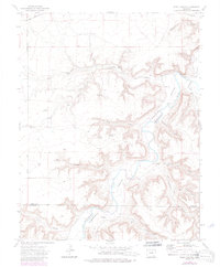
1972 Map of Riley Canyon
USGS Topo · Published 1984About this map
The Purgatoire River carves a deep, winding path through the high plains of southern Colorado, defining the landscape of the border between Otero and Las Animas Counties. In the early 1970s, this area remained largely dominated by ranching and remote infrastructure, evidenced by landmarks like the Girard Windmill and Little Windmill. The presence of the Penitenta Ch and the Martinez Cem in the northeast corner, near the Ninemile Valley, points to the long-standing localized settlements that persisted even as much of the surrounding territory was defined by canyon drainages like Riley Canyon and Withers Canyon. Water remains the central character of the map, from the Gaging Sta on the river to isolated spots like Rock Waterhole and Antone Spring, which provided essential resources in an otherwise arid environment.
Find a feature on this map
31 named features on this map. Tap any name to fly to it.
Don’t see what you’re looking for? This feature index may not catch every label — zoom into the map to look around manually.
Map Details
Editions of this 1972 Riley Canyon Map
5 editions found
Other maps of this area

1891 · Higbee
USGS Topo · 1:125,000

1891 · Timpas
USGS Topo · 1:125,000

1893 · Higbee
USGS Topo · 1:125,000

1894 · Timpas
USGS Topo · 1:125,000

1955 · La Junta
USGS Topo · 1:250,000

1958 · La Junta
USGS Topo · 1:250,000

1965 · La Junta SW
USGS Topo · 1:24,000

1966 · La Junta SE
USGS Topo · 1:24,000
1966 · Higbee
USGS Topo · 1:24,000

1968 · La Junta
USGS Topo · 1:250,000