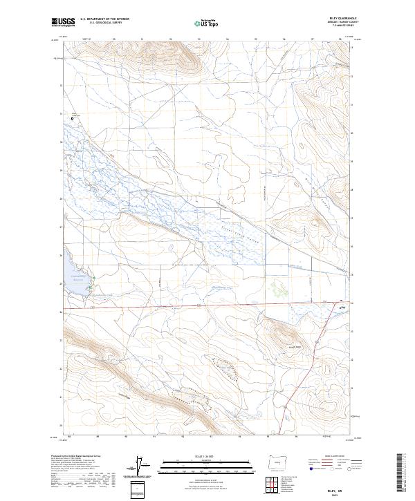
2023 Map of Riley
USGS Topo · Published 2023About this map
Silver Creek Valley and its surrounding high-desert terrain define this modern survey of the area near Riley. The landscape transitions from the riparian corridor of Silver Creek to the prominent heights of Juniper Ridge and the volcanic profile of Shields Butte. Water management is central to the geography here, evidenced by the Chickahominy Reservoir and the drainage of Chickahominy Creek across the central flats. Local history and genealogy are anchored by the Silver Creek Cem located along Best Ln in the northwest. The road network, including Silver Creek Rd and Dick Miller Rd, traces the routes between canyons and basins, while features like Gumboot Canyon and Cream Lake provide specific landmarks within the township and range grid of Harney County.
Find a feature on this map
24 named features on this map. Tap any name to fly to it.
Don’t see what you’re looking for? This feature index may not catch every label — zoom into the map to look around manually.
Map Details
Editions of this 2023 Riley Map
This is the sole edition of this map. No revisions or reprints were ever made.
Other maps of this area

1955 · Burns
USGS Topo · 1:250,000

1958 · Burns
USGS Topo · 1:250,000

1959 · Burns
USGS Topo · 1:250,000

1979 · Moon Reservoir
USGS Topo · 1:24,000

1980 · Capehart Lake
USGS Topo · 1:24,000

1980 · Squaw Butte
USGS Topo · 1:24,000
1981 · Egypt Canyon
USGS Topo · 1:24,000
1981 · Oakerman Lakes
USGS Topo · 1:24,000

1981 · Camp Currey Spring
USGS Topo · 1:24,000
1981 · Suntex
USGS Topo · 1:24,000