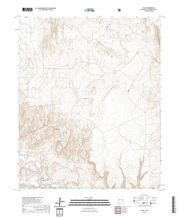
2023 Map of Riley
USGS Topo · Published 2023About this map
Riley sits along the northern edge of the Rio Salado in Socorro County, serving as a focal point for this high-desert landscape. The local history of the settlement is anchored by the Santa Rita Church and Cem, located just south of the main cluster of buildings. The terrain is defined by dramatic elevations including Yellow Mtn and the Sierra Lucero, which overlook a network of seasonal watercourses such as Coyote Draw.
Find a feature on this map
17 named features on this map. Tap any name to fly to it.
Don’t see what you’re looking for? This feature index may not catch every label — zoom into the map to look around manually.
Map Details
Editions of this 2023 Riley Map
This is the sole edition of this map. No revisions or reprints were ever made.
Other maps of this area

1917 · Cerro Verde
USGS Topo · 1:125,000

1954 · Socorro
USGS Topo · 1:250,000

1956 · Mesa Aparejo
USGS Topo · 1:62,500

1958 · Socorro
USGS Topo · 1:250,000

1959 · Riley
USGS Topo · 1:62,500

1962 · Socorro
USGS Topo · 1:250,000

1964 · La Jara Peak
USGS Topo · 1:24,000
1964 · Puerto De Los Cavadores
USGS Topo · 1:24,000
1964 · Mesa Cencerro
USGS Topo · 1:24,000
1978 · Acoma Pueblo
USGS Topo · 1:100,000