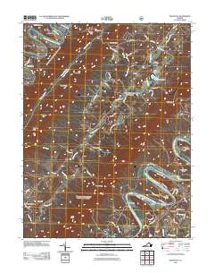
2011 Map of Rileyville
USGS Topo · Published 2011About this map
The North Fork Shenandoah River and South Fork Shenandoah River carve their paths through the terrain near the small settlement of Rileyville. This survey illustrates a landscape defined by river landings and gap crossings, reflecting a historical reliance on the water for both transport and industry. Notable river access points like Fosters Landing, Goods Landing, and Seak Ford Landing are clearly marked, while Goods Mill suggests the area's agricultural and industrial heritage.
Find a feature on this map
81 named features on this map. Tap any name to fly to it.
Don’t see what you’re looking for? This feature index may not catch every label — zoom into the map to look around manually.
Map Details
Editions of this 2011 Rileyville Map
This is the sole edition of this map. No revisions or reprints were ever made.
Other maps of this area

1892 · Woodstock
USGS Topo · 1:125,000

1893 · Luray
USGS Topo · 1:125,000

1905 · Luray
USGS Topo · 1:125,000

1923 · Edinburg
USGS Topo · 1:62,500

1929 · Stony Man
USGS Topo · 1:48,000

1933 · Stony Man
USGS Topo · 1:62,500

1942 · Mt Jackson
USGS Topo · 1:62,500

1946 · Mt Jackson
USGS Topo · 1:62,500

1947 · Mt Jackson
USGS Topo · 1:62,500

1947 · Strasburg
USGS Topo · 1:62,500