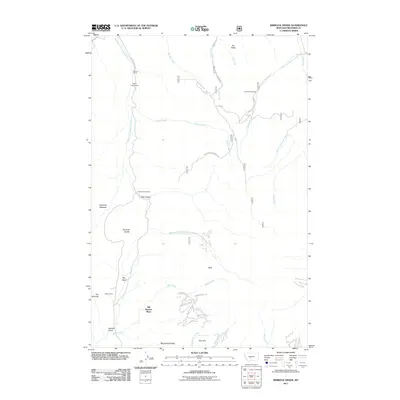
2011 Map of Rimrock Divide
USGS Topo · Published 2011About this map
Bill Bracket Place and several family-named homesteads anchor this 2011 survey of the Meagher County backcountry. The landscape is defined by the Bozeman Fork Musselshell River and the high terrain of the Rimrock Divide, where the waters split between the Musselshell and Sixteenmile Creek drainages. The map records a series of traditional landholdings and camps, including the Rostad Ranch, Hoyem Homestead, and Glenns Cabin, reflecting the long-standing ranching and settlement patterns of this part of Montana.
Find a feature on this map
39 named features on this map. Tap any name to fly to it.
Don’t see what you’re looking for? This feature index may not catch every label — zoom into the map to look around manually.
Map Details
Editions of this 2011 Rimrock Divide Map
This is the sole edition of this map. No revisions or reprints were ever made.
Other maps of this area

1886 · Little Belt Mts.
USGS Topo · 1:250,000

1894 · Little Belt Mts.
USGS Topo · 1:250,000

1897 · Little Belt Mts.
USGS Topo · 1:250,000

1898 · Little Belt Mts.
USGS Topo · 1:250,000

1902 · Little Belt Mts.
USGS Topo · 1:250,000

1948 · White Sulphur Springs
USGS Topo · 1:250,000

1951 · Hamen
USGS Topo · 1:24,000
1951 · Wolf Hill
USGS Topo · 1:24,000

1951 · Rimrock Divide
USGS Topo · 1:24,000

1958 · White Sulphur Springs
USGS Topo · 1:250,000