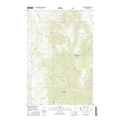
2017 Map of Rimrock Divide
USGS Topo · Published 2017About this map
Rimrock Divide serves as a significant geographical crest within the Crazy Mountains, defining the watershed of Meagher County. The high-altitude terrain is dominated by the headwaters of the Bozeman Fork Musselshell River, which flows through the northern reaches of the quadrangle. This area marks the convergence of two major federal lands: the Lewis & Clark National Forest and the Gallatin National Forest.
Find a feature on this map
38 named features on this map. Tap any name to fly to it.
Don’t see what you’re looking for? This feature index may not catch every label — zoom into the map to look around manually.
Map Details
Editions of this 2017 Rimrock Divide Map
This is the sole edition of this map. No revisions or reprints were ever made.
Other maps of this area

1886 · Little Belt Mts.
USGS Topo · 1:250,000

1894 · Little Belt Mts.
USGS Topo · 1:250,000

1897 · Little Belt Mts.
USGS Topo · 1:250,000

1898 · Little Belt Mts.
USGS Topo · 1:250,000

1902 · Little Belt Mts.
USGS Topo · 1:250,000

1948 · White Sulphur Springs
USGS Topo · 1:250,000

1951 · Hamen
USGS Topo · 1:24,000
1951 · Wolf Hill
USGS Topo · 1:24,000

1951 · Rimrock Divide
USGS Topo · 1:24,000

1958 · White Sulphur Springs
USGS Topo · 1:250,000