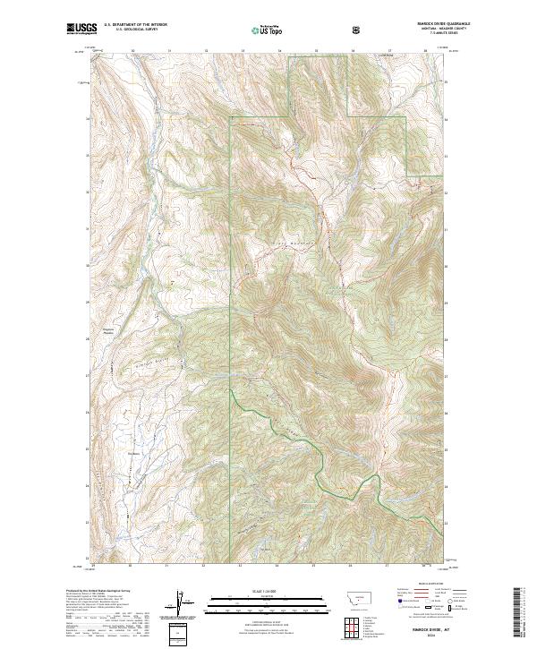
2024 Map of Rimrock Divide
USGS Topo · Published 2024About this map
The Crazy Mountains dominate this high-altitude terrain in Meagher County, where the Rimrock Divide separates major drainages within the northern Rockies. This landscape is a point of intersection for federal lands, split between the Lewis & Clark National Forest and Gallatin National Forest. The hydrological network is complex, featuring the headwaters of the Bozeman Fork Musselshell River alongside smaller alpine runs like Billy Creek and Sixteenmile Creek. Extensive trail systems, such as the Indian Ridge-Eike Trl and Bald Ridge Driveway Trl, navigate the steep ridges and basins. Named landmarks like Haypress Meadow, The Basin, and The Rimrock highlight the varied topography of this wilderness area, offering specific points of interest for backcountry researchers and those tracing the historical boundaries of Montana’s national forests.
Find a feature on this map
41 named features on this map. Tap any name to fly to it.
Don’t see what you’re looking for? This feature index may not catch every label — zoom into the map to look around manually.
Map Details
Editions of this 2024 Rimrock Divide Map
This is the sole edition of this map. No revisions or reprints were ever made.
Other maps of this area

1886 · Little Belt Mts.
USGS Topo · 1:250,000

1894 · Little Belt Mts.
USGS Topo · 1:250,000

1897 · Little Belt Mts.
USGS Topo · 1:250,000

1898 · Little Belt Mts.
USGS Topo · 1:250,000

1902 · Little Belt Mts.
USGS Topo · 1:250,000

1948 · White Sulphur Springs
USGS Topo · 1:250,000

1951 · Hamen
USGS Topo · 1:24,000
1951 · Wolf Hill
USGS Topo · 1:24,000

1951 · Rimrock Divide
USGS Topo · 1:24,000

1958 · White Sulphur Springs
USGS Topo · 1:250,000