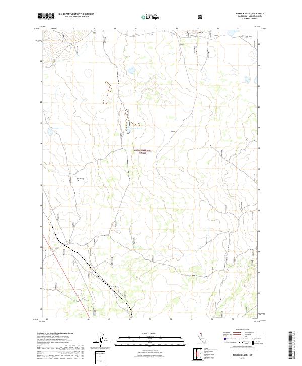
2021 Map of Rimrock Lake
USGS Topo · Published 2021About this map
Modoc National Forest dominates this section of the Modoc County high country, revealing a landscape defined by seasonal water and specialized infrastructure. The terrain is marked by several distinct basins, including the waters of Clear Lake, Cummins Lake, and the namesake Rimrock Lake. These features, along with the broad expanse of Bob Young Flat, suggest a region used for cattle grazing and natural resource management within the forest boundaries. A notable modern addition to the landscape is the OTH Radar installation, a specialized facility that stands in contrast to the surrounding wilderness. The transportation network is anchored by State Route 139, which provides the primary access through these high-altitude flats and lake basins.
Find a feature on this map
11 named features on this map. Tap any name to fly to it.
Don’t see what you’re looking for? This feature index may not catch every label — zoom into the map to look around manually.
Map Details
Editions of this 2021 Rimrock Lake Map
This is the sole edition of this map. No revisions or reprints were ever made.
Other maps of this area

1886 · Modoc Lava Bed
USGS Topo · 1:250,000

1892 · Modoc Lava-Bed
USGS Topo · 1:250,000

1951 · Clear Lake Reservoir
USGS Topo · 1:62,500

1951 · Tulelake
USGS Topo · 1:62,500

1952 · Timber Mountain
USGS Topo · 1:62,500

1952 · Hackamore
USGS Topo · 1:62,500

1954 · Alturas
USGS Topo · 1:250,000

1958 · Alturas
USGS Topo · 1:250,000

1962 · Alturas
USGS Topo · 1:250,000

1965 · Alturas
USGS Topo · 1:250,000