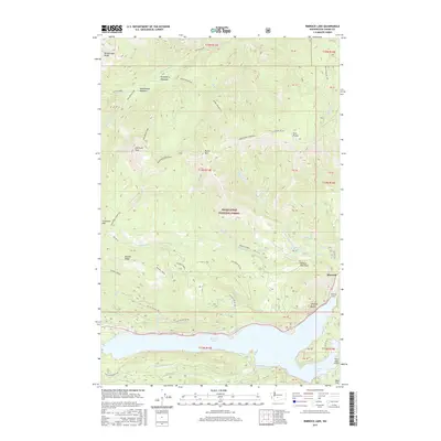
2017 Map of Rimrock Lake
USGS Topo · Published 2017About this map
Rimrock Lake and the surrounding high-elevation terrain of the Snoqualmie National Forest dominate this topographical study in Yakima County. The settlement of Rimrock is situated at the eastern edge of the reservoir, near the infrastructure of the Rimrock Tunnel and the distinctive geological formation of Westfall Rocks. The map documents a landscape defined by significant elevation changes, with peaks such as Shellrock Peak and Ironstone Mountain rising above high-altitude grazing and transit areas like Strawberry Meadows and Cash Prairie.
Find a feature on this map
55 named features on this map. Tap any name to fly to it.
Don’t see what you’re looking for? This feature index may not catch every label — zoom into the map to look around manually.
Map Details
Editions of this 2017 Rimrock Lake Map
This is the sole edition of this map. No revisions or reprints were ever made.
Other maps of this area

1902 · Mount Aix
USGS Topo · 1:125,000

1904 · Mt Aix
USGS Topo · 1:125,000

1950 · Yakima
USGS Topo · 1:250,000

1958 · Yakima
USGS Topo · 1:250,000

1961 · Yakima
USGS Topo · 1:250,000

1962 · Bumping Lake
USGS Topo · 1:62,500

1962 · White Pass
USGS Topo · 1:62,500

1967 · Rimrock Lake
USGS Topo · 1:24,000

1967 · Tieton Basin
USGS Topo · 1:24,000

1967 · Darland Mtn
USGS Topo · 1:24,000