
1967 Map of Darland Mtn
USGS Topo · Published 1970About this map
Snoqualmie National Forest dominates this section of the Cascade Range, characterized by a complex network of high ridges and alpine meadows. The terrain is defined by prominent elevations such as Pinegrass Ridge and Divide Ridge, which channel drainage into the South Fork Tieton River and the forks of Ahtanum Creek. High-altitude landmarks like the Blue Slide Lookout Tower on Blue Slide indicate the area's importance for fire observation and forest management during the mid-20th century.
Find a feature on this map
44 named features on this map. Tap any name to fly to it.
Don’t see what you’re looking for? This feature index may not catch every label — zoom into the map to look around manually.
Map Details
Editions of this 1967 Darland Mtn Map
4 editions found
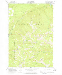
Other maps of this area

1902 · Mount Aix
USGS Topo · 1:125,000

1904 · Mt Aix
USGS Topo · 1:125,000

1904 · Mount Adams
USGS Topo · 1:125,000

1907 · Mount Adams
USGS Topo · 1:125,000

1950 · Yakima
USGS Topo · 1:250,000

1958 · Yakima
USGS Topo · 1:250,000

1961 · Yakima
USGS Topo · 1:250,000

1962 · White Pass
USGS Topo · 1:62,500

1967 · Rimrock Lake
USGS Topo · 1:24,000

1967 · Tieton Basin
USGS Topo · 1:24,000