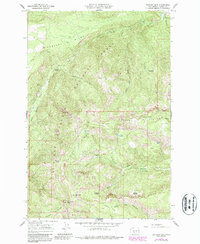
1967 Map of Darland Mtn
USGS Topo · Published 1987About this map
Darland Mtn anchors the southern portion of this landscape where the Yakima Indian Reservation meets the Mount Baker-Snoqualmie National Forest. The map captures a high-elevation wilderness defined by prominent geologic divides, including Divide Ridge and Whites Ridge. Water resources are central to the terrain, with the South Fork Tieton River and its tributaries like Spruce Creek and Short and Dirty Creek carving through the ridges. Recreational access is marked by the South Fork Campground and Grey Creek Campground, while seasonal meadows like Buckhorn Meadows and Minnie Meadows suggest the grazing and ecological transitions of the Cascades in the late 1960s. The presence of features like Narrowneck Gap and Bakeoven Flats provides specific landmarks for backcountry navigation and local history.
Find a feature on this map
39 named features on this map. Tap any name to fly to it.
Don’t see what you’re looking for? This feature index may not catch every label — zoom into the map to look around manually.
Map Details
Editions of this 1967 Darland Mtn Map
4 editions found

Other maps of this area

1902 · Mount Aix
USGS Topo · 1:125,000

1904 · Mt Aix
USGS Topo · 1:125,000

1904 · Mount Adams
USGS Topo · 1:125,000

1907 · Mount Adams
USGS Topo · 1:125,000

1950 · Yakima
USGS Topo · 1:250,000

1958 · Yakima
USGS Topo · 1:250,000

1961 · Yakima
USGS Topo · 1:250,000

1962 · White Pass
USGS Topo · 1:62,500

1967 · Rimrock Lake
USGS Topo · 1:24,000

1967 · Tieton Basin
USGS Topo · 1:24,000