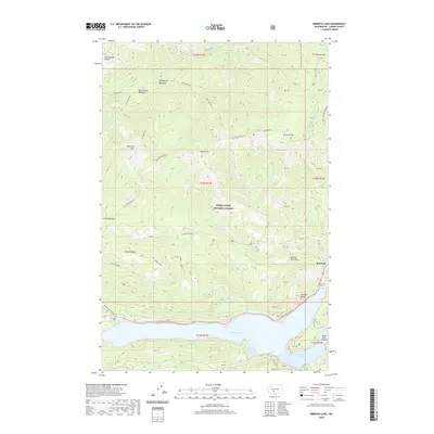
2020 Map of Rimrock Lake
USGS Topo · Published 2020About this map
Rimrock Lake and its surrounding mountain ridges dominate this part of the Snoqualmie National Forest, where transportation and recreation infrastructure follow the water's edge. The White Pass Highway skirts the northern shoreline, passing through the Rimrock Tunnel near the settlement of Rimrock. This area serves as a critical point for backcountry access, evidenced by the presence of the Tieton State Airport and the numerous coves such as Silver Salmon Cove and Lonesome Cove.
Find a feature on this map
46 named features on this map. Tap any name to fly to it.
Don’t see what you’re looking for? This feature index may not catch every label — zoom into the map to look around manually.
Map Details
Editions of this 2020 Rimrock Lake Map
This is the sole edition of this map. No revisions or reprints were ever made.
Other maps of this area

1902 · Mount Aix
USGS Topo · 1:125,000

1904 · Mt Aix
USGS Topo · 1:125,000

1950 · Yakima
USGS Topo · 1:250,000

1958 · Yakima
USGS Topo · 1:250,000

1961 · Yakima
USGS Topo · 1:250,000

1962 · Bumping Lake
USGS Topo · 1:62,500

1962 · White Pass
USGS Topo · 1:62,500

1967 · Rimrock Lake
USGS Topo · 1:24,000

1967 · Tieton Basin
USGS Topo · 1:24,000

1967 · Darland Mtn
USGS Topo · 1:24,000