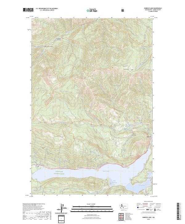
2023 Map of Rimrock Lake
USGS Topo · Published 2023About this map
Rimrock Lake and its northern mountain drainages define this high-altitude landscape in the Yakima region. The map reveals a high-elevation network of trails and peaks, including the William O Douglas Wilderness and high-altitude pastures like Strawberry Meadows and Cash Prairie. The settlement of Rimrock sits at the edge of the lake, serving as a gateway to the steep ridges of Russell Ridge and Bethel Ridge. This 2023 edition documents the modern recreational and aviation infrastructure of the area, most notably the Tieton State Airport and the White Pass Highway corridor along the southern shore. The topography is marked by distinctive geological formations such as the Wildcat Post Piles and the heights of Shellrock Peak, while numerous named creeks including Rattlesnake Creek and Wildcat Creek cut deep through the surrounding national forest lands.
Find a feature on this map
51 named features on this map. Tap any name to fly to it.
Don’t see what you’re looking for? This feature index may not catch every label — zoom into the map to look around manually.
Map Details
Editions of this 2023 Rimrock Lake Map
This is the sole edition of this map. No revisions or reprints were ever made.
Other maps of this area

1902 · Mount Aix
USGS Topo · 1:125,000

1904 · Mt Aix
USGS Topo · 1:125,000

1950 · Yakima
USGS Topo · 1:250,000

1958 · Yakima
USGS Topo · 1:250,000

1961 · Yakima
USGS Topo · 1:250,000

1962 · Bumping Lake
USGS Topo · 1:62,500

1962 · White Pass
USGS Topo · 1:62,500

1967 · Rimrock Lake
USGS Topo · 1:24,000

1967 · Tieton Basin
USGS Topo · 1:24,000

1967 · Darland Mtn
USGS Topo · 1:24,000