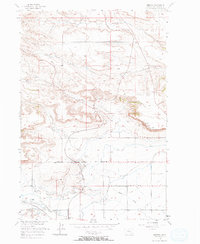
1956 Map of Rimrock
USGS Topo · Published 1971About this map
Alkali Creek and its many forks define the northern geography of this Yellowstone County landscape, where the Rimrocks form a striking geological bench above the valley floor. The map documents a transition from the dissected uplands in the north to an extensively irrigated agricultural plain in the south. This lower terrain is crisscrossed by a complex network of water management features, including the Cove Ditch, High Ditch, and Big Snow Ditch, supporting the local homesteads.
Find a feature on this map
31 named features on this map. Tap any name to fly to it.
Don’t see what you’re looking for? This feature index may not catch every label — zoom into the map to look around manually.
Map Details
Editions of this 1956 Rimrock Map
3 editions found
Other maps of this area

1954 · Billings
USGS Topo · 1:250,000

1956 · Comanche
USGS Topo · 1:24,000

1956 · Acton
USGS Topo · 1:24,000

1956 · Hickson Ranch
USGS Topo · 1:24,000

1956 · Rimrock
USGS Topo · 1:24,000

1956 · Two Pine School
USGS Topo · 1:24,000

1956 · Laurel
USGS Topo · 1:24,000

1956 · Yegen
USGS Topo · 1:24,000

1956 · Mossmain
USGS Topo · 1:24,000

1957 · Billings
USGS Topo · 1:250,000