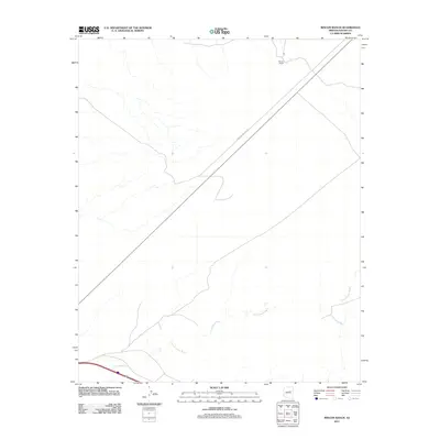
2011 Map of Rincon Ranch
USGS Topo · Published 2011About this map
Rincon Ranch sits at the northern edge of this high-desert landscape in Navajo County, representing a pocket of settlement within a network of ephemeral watercourses and transit routes. The terrain is defined by the drainage patterns of Cottonwood Wash and its tributary, Fern Feather Wash, which carve through the arid surface. Cutting diagonally across the quadrangle, the Winslow-Polacca Rd serves as the primary artery through the region, linking the namesake ranching area to larger regional hubs. This survey provides a clear view of the sparse human footprint in this part of Arizona in the early twenty-first century, highlighting how water features and road access dictate the location of ranching operations.
Find a feature on this map
4 named features on this map. Tap any name to fly to it.
Don’t see what you’re looking for? This feature index may not catch every label — zoom into the map to look around manually.
Map Details
Editions of this 2011 Rincon Ranch Map
This is the sole edition of this map. No revisions or reprints were ever made.
Other maps of this area

1883 · Tusayan
USGS Topo · 1:250,000

1886 · Tusayan
USGS Topo · 1:250,000

1886 · Holbrook
USGS Topo · 1:250,000

1893 · Holbrook
USGS Topo · 1:250,000

1947 · Flagstaff
USGS Topo · 1:250,000

1954 · Winslow
USGS Topo · 1:62,500

1954 · Winslow 4 NW
USGS Topo · 1:24,000

1954 · Winslow 4 SW
USGS Topo · 1:24,000

1954 · Winslow 4 SE
USGS Topo · 1:24,000

1954 · Winslow 4 NE
USGS Topo · 1:24,000