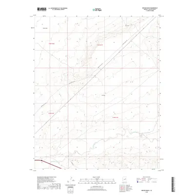
2018 Map of Rincon Ranch
USGS Topo · Published 2018About this map
Rincon Ranch and the high desert terrain of Navajo County are captured in this 2018 topographic study. The landscape is defined by the broad Ives Mesa and the topographical depression of the Rincon Basin, reflecting a region shaped by intermittent drainage patterns. The primary transport artery, Winslow-Polacca Rd, cuts diagonally across the township grids, connecting remote ranching interests with the wider region. Below the mesa, the hydraulic character of the land is revealed through the courses of Cottonwood Wash and Fern Feather Wash, which serve as the primary conduits for seasonal runoff. This survey provides a precise record of the road network, including Hibbard Rd, and the established land divisions within the Navajo County interior during the early 21st century.
Find a feature on this map
11 named features on this map. Tap any name to fly to it.
Don’t see what you’re looking for? This feature index may not catch every label — zoom into the map to look around manually.
Map Details
Editions of this 2018 Rincon Ranch Map
This is the sole edition of this map. No revisions or reprints were ever made.
Other maps of this area

1883 · Tusayan
USGS Topo · 1:250,000

1886 · Tusayan
USGS Topo · 1:250,000

1886 · Holbrook
USGS Topo · 1:250,000

1893 · Holbrook
USGS Topo · 1:250,000

1947 · Flagstaff
USGS Topo · 1:250,000

1954 · Winslow
USGS Topo · 1:62,500

1954 · Winslow 4 NW
USGS Topo · 1:24,000

1954 · Winslow 4 SW
USGS Topo · 1:24,000

1954 · Winslow 4 SE
USGS Topo · 1:24,000

1954 · Winslow 4 NE
USGS Topo · 1:24,000