
1941 Map of Rincon
USGS Topo · Published 1941About this map
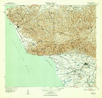
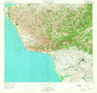
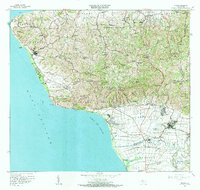
Sugar production and rail transport define the coastal landscape of western Puerto Rico on the eve of World War II. The American Railroad of Puerto Rico winds along the shoreline, connecting the port area of Rincon to industrial processing centers like Central Igualdad and Central Eureka. This transportation network supported a vast system of agricultural estates, or colonias, such as Colonia Trinidad, Colonia Pagan, and Colonia Josefa, which dominate the fertile lowlands surrounding Añasco.
Find a feature on this map
62 named features on this map. Tap any name to fly to it.
Don’t see what you’re looking for? This feature index may not catch every label — zoom into the map to look around manually.
Map Details
Editions of this 1941 Rincon Map
This is the sole edition of this map. No revisions or reprints were ever made.
Historical Maps of Añasco Through Time
15 maps found
1941 Rincon
Rincón Municipio, PR

1941 Rincon
Rincón Municipio, PR

1947 Rincon
Rincón Municipio, PR

1947 Rincon
Rincón Municipio, PR
1949 Rincon
Rincón Municipio, PR
1950 Rincon NO
Rincón Municipio, PR
1950 Rincon ONO
Rincón Municipio, PR
1955 Rincon
Rincón Municipio, PR
1966 Rincon
Rincón Municipio, PR
2013 Rincon OE W
Rincón Municipio, PR
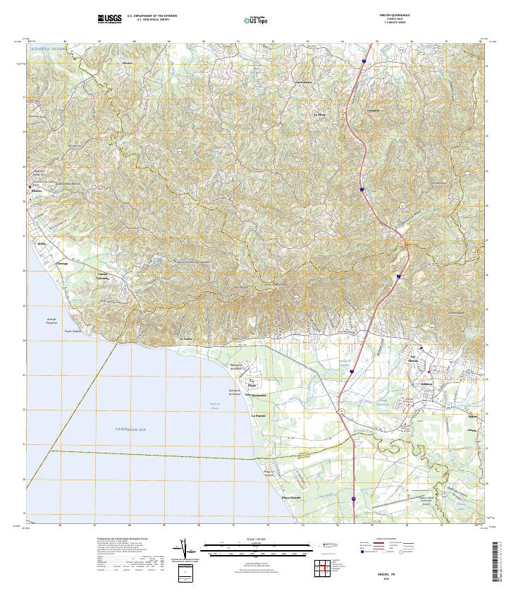
2013 Rincon
Rincón Municipio, PR
2018 Rincon OE W
Rincón Municipio, PR
2018 Rincon
Rincón Municipio, PR
2024 Rincon OE W
Rincón Municipio, PR
2024 Rincon
Rincón Municipio, PR
Featured Locations
- Villas del Río Ingenio, Aguada
- Sector García, Aguada
- Sector Pilar Figueroa, Aguada
- Rincón, Rincón
- Añasco, Añasco