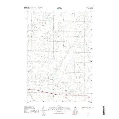
2018 Map of Ringle
USGS Topo · Published 2018About this map
The Eau Claire River and its numerous tributaries, including Mole Brook and Little Sandy Cr, dominate this landscape in Marathon County. The settlement of Ringle serves as a local hub, situated near the transition between the rolling woodlands to the north and the expanding footprint of Weston in the southwest corner. The map documents a rural character defined by a grid of county roads and named lanes, such as Sunset-Valley Rd and Wonderland Rd, that reflect local family history and geographic orientation.
Find a feature on this map
67 named features on this map. Tap any name to fly to it.
Don’t see what you’re looking for? This feature index may not catch every label — zoom into the map to look around manually.
Map Details
Editions of this 2018 Ringle Map
This is the sole edition of this map. No revisions or reprints were ever made.
Other maps of this area

1899 · Wausau
USGS Topo · 1:125,000

1902 · Wausau
USGS Topo · 1:125,000

1951 · Doering
USGS Topo · 1:48,000

1951 · Merrill
USGS Topo · 1:48,000

1953 · Wausau
USGS Topo · 1:48,000

1953 · Hatley
USGS Topo · 1:48,000

1954 · Iron Mountain
USGS Topo · 1:250,000

1955 · Green Bay
USGS Topo · 1:250,000

1959 · Iron Mountain
USGS Topo · 1:250,000
1963 · Wausau East
USGS Topo · 1:24,000