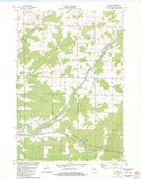
1982 Map of Ringle
USGS Topo · Published 1982About this map
The Eau Claire River carves a winding path through this central Wisconsin landscape, defining the boundaries and development of Easton and Ringle townships. At the time of this 1982 edition, the Chicago and North Western railroad remains a primary transit artery, passing directly through the community of Ringle near Clay Pond. The map reveals a rural structure centered on small crossroads and local institutions, evidenced by the presence of the St Johns Sch and New Hope Ch.
Find a feature on this map
30 named features on this map. Tap any name to fly to it.
Don’t see what you’re looking for? This feature index may not catch every label — zoom into the map to look around manually.
Map Details
Editions of this 1982 Ringle Map
This is the sole edition of this map. No revisions or reprints were ever made.
Other maps of this area

1899 · Wausau
USGS Topo · 1:125,000

1902 · Wausau
USGS Topo · 1:125,000

1951 · Doering
USGS Topo · 1:48,000

1951 · Merrill
USGS Topo · 1:48,000

1953 · Wausau
USGS Topo · 1:48,000

1953 · Hatley
USGS Topo · 1:48,000

1954 · Iron Mountain
USGS Topo · 1:250,000

1955 · Green Bay
USGS Topo · 1:250,000

1959 · Iron Mountain
USGS Topo · 1:250,000
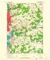
1963 · Wausau East
USGS Topo · 1:24,000