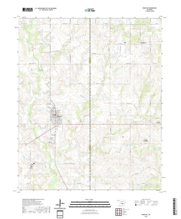
2022 Map of Ringling
USGS Topo · Published 2022About this map
Ringling and its nearby neighbor Cornish sit at the intersection of local history in this portion of Southern Oklahoma. The map documents the grid of the town site and the surrounding landscape, which is defined by a dense network of country roads named for local families and early industry, including Dale Faulkner Rd and Noble Crook Wade Blvd. To the east, the oil-country heritage of the region is visible near Healdton and Wirt, where roads like Mobil Rd and Arco Rd trace the path of petroleum development. Several watercourses, including Post Oak Cr and N Mud Cr, wind through the section lines, while the Cornish Cem and Ringling Memorial Cem serve as vital landmarks for those tracing family roots in Jefferson and Carter counties.
Find a feature on this map
87 named features on this map. Tap any name to fly to it.
Don’t see what you’re looking for? This feature index may not catch every label — zoom into the map to look around manually.
Map Details
Editions of this 2022 Ringling Map
This is the sole edition of this map. No revisions or reprints were ever made.
Other maps of this area

1901 · Addington
USGS Topo · 1:125,000

1901 · Ardmore
USGS Topo · 1:125,000

1918 · Ardmore
USGS Topo · 1:125,000

1957 · Ardmore
USGS Topo · 1:250,000

1963 · Ardmore
USGS Topo · 1:250,000

1969 · Healdton
USGS Topo · 1:24,000
1969 · Healdton SW
USGS Topo · 1:24,000
1969 · Fox
USGS Topo · 1:24,000
1974 · Orr
USGS Topo · 1:24,000

1974 · Ringling NW
USGS Topo · 1:24,000