
1963 Map of Ringwood
USGS Topo · Published 1964About this map
Fishing Creek and its many winding tributaries define this rural landscape on the border of Halifax and Nash Counties in the early 1960s. The settlement of Ringwood serves as a local hub, surrounded by a dense network of family cemeteries and country churches that speak to the deep-rooted community history of the area. Features like Turkey Branch Ch, Saints Chapel, and the Eastman Sch highlight the social foundations of these small crossroads.
Find a feature on this map
38 named features on this map. Tap any name to fly to it.
Don’t see what you’re looking for? This feature index may not catch every label — zoom into the map to look around manually.
Map Details
Editions of this 1963 Ringwood Map
This is the sole edition of this map. No revisions or reprints were ever made.
Other maps of this area

1953 · Norfolk
USGS Topo · 1:250,000

1961 · Whitakers
USGS Topo · 1:24,000

1961 · Enfield
USGS Topo · 1:24,000

1963 · Red Oak
USGS Topo · 1:24,000

1963 · Essex
USGS Topo · 1:24,000

1963 · Drake
USGS Topo · 1:24,000

1973 · Aurelian Springs
USGS Topo · 1:24,000

1973 · Hollister
USGS Topo · 1:24,000

1974 · Darlington
USGS Topo · 1:24,000
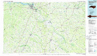
1985 · Roanoke Rapids
USGS Topo · 1:100,000