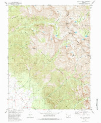
1980 Map of Rio Alto Peak
USGS Topo · Published 1985About this map
High-altitude basins and jagged divides define this portion of the Sangre de Cristo Range, where the Rio Grande National Forest meets the San Isabel National Forest. The landscape is a network of glacial tarns and steep drainages, with Rito Alto Peak and Spread Eagle Peak marking the rugged boundary between Saguache and Custer counties. Notable water bodies such as Blind Lake, Elaine Lake, and Mas Alto Lake are tucked into the cirques below the ridges, connected by a system of pack and jeep trails that follow the natural contours of North Fork and Rito Alto Creek.
Find a feature on this map
56 named features on this map. Tap any name to fly to it.
Don’t see what you’re looking for? This feature index may not catch every label — zoom into the map to look around manually.
Map Details
Editions of this 1980 Rio Alto Peak Map
4 editions found
Other maps of this area

1950 · Valley View Hot Springs
USGS Topo · 1:24,000

1954 · Trinidad
USGS Topo · 1:250,000

1954 · Pueblo
USGS Topo · 1:250,000

1955 · Trinidad
USGS Topo · 1:250,000

1957 · Pueblo
USGS Topo · 1:250,000

1958 · Trinidad
USGS Topo · 1:250,000

1958 · Pueblo
USGS Topo · 1:250,000

1958 · Beckwith Mountain
USGS Topo · 1:24,000

1959 · Trinidad
USGS Topo · 1:250,000

1959 · Electric Peak
USGS Topo · 1:62,500