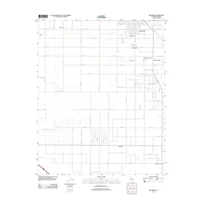
2012 Map of Rio Bravo
USGS Topo · Published 2012About this map
Agricultural enterprise and energy extraction define this Central Valley landscape, centered on the southern portions of Shafter. The grid-based settlement pattern is punctuated by specialized dairy operations like Oasis Holsteins Dairy, Aukeman Dairy, and Tjaarda Dairy, reflecting the region's intensive land use in the early 21st century. Industrial activity is concentrated at the Rio Bravo Oil Field, where the infrastructure for petroleum extraction interfaces with the surrounding fields. Distinct neighborhood enclaves such as Mexican Colony and Cherokee Strip appear alongside rural intersections like Smith Corner and Calders Corner. The map reveals a highly engineered environment, where long arterial roads like 7th Standard Rd and S Central Valley Hwy facilitate the movement of goods between the town of Rio Bravo and the broader Kern County transport network.
Find a feature on this map
78 named features on this map. Tap any name to fly to it.
Don’t see what you’re looking for? This feature index may not catch every label — zoom into the map to look around manually.
Map Details
Editions of this 2012 Rio Bravo Map
This is the sole edition of this map. No revisions or reprints were ever made.
Other maps of this area

1910 · Buena Vista Lake
USGS Topo · 1:125,000

1912 · Buena Vista Lake
USGS Topo · 1:125,000

1929 · Stevens
USGS Topo · 1:31,680

1929 · Coles Levee
USGS Topo · 1:31,680

1930 · Leonards
USGS Topo · 1:31,680

1930 · Wasco
USGS Topo · 1:31,680

1930 · Famoso
USGS Topo · 1:31,680

1930 · Rosedale
USGS Topo · 1:31,680

1931 · Rio Bravo
USGS Topo · 1:31,680

1932 · East Elk Hills
USGS Topo · 1:31,680