
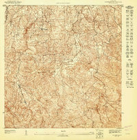
1950 Map of Rio Grande SE
USGS Topo · Published 1950About this map
Coastal wetlands and rising interior hills define this landscape where the Río Espíritu Santo and Río Herrera reach the Océano Atlántico. The topography captures a period of agrarian activity centered around the Colonia Carmelita and Colonia Fortuna, with infrastructure like the Desvío Carmelita and Desvío Florida suggesting the movement of goods through the lowlands. Extensive marshlands, including Ciénaga La Picúa and the Ensenada Comezón, separate the coastline at Pta Miquillo from the inland ridges.
Find a feature on this map
29 named features on this map. Tap any name to fly to it.
Don’t see what you’re looking for? This feature index may not catch every label — zoom into the map to look around manually.
Map Details
Editions of this 1950 Rio Grande SE Map
This is the sole edition of this map. No revisions or reprints were ever made.
Other maps of this area

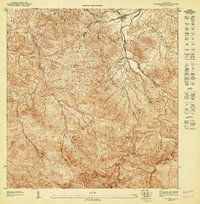
1941 · Rio Grande
USGS Topo · 1:30,000

1945 · El Yunque
USGS Topo · 1:30,000

1946 · El Yunque
USGS Topo · 1:30,000

1946 · Fajardo
USGS Topo · 1:30,000
1947 · El Yunque NE
USGS Topo · 1:10,000

1947 · Rio Grande
USGS Topo · 1:30,000
1947 · El Yunque NO
USGS Topo · 1:10,000
1947 · Fajardo NO
USGS Topo · 1:10,000

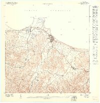
1949 · Rio Grande SO
USGS Topo · 1:10,000

1952 · El Yunque
USGS Topo · 1:30,000