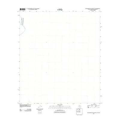
2011 Map of Rio Grande Village OE E
USGS Topo · Published 2011About this map
The Rio Grande cuts through the northwest corner of this quadrangle, defining the international boundary between the United States of America and Estados Unidos Mexicanos. This remote stretch of the river landscape is characterized by its isolation and the stark demarcation of the border. While the map is sparse in terms of named settlements, it documents the exact topographic profile and river course as it existed in 2011. For researchers of border history and the geography of the Big Bend region, this survey provides a precise look at the drainage patterns and terrain of the Chihuahuan Desert before more recent environmental changes.
Find a feature on this map
2 named features on this map. Tap any name to fly to it.
Don’t see what you’re looking for? This feature index may not catch every label — zoom into the map to look around manually.
Map Details
Editions of this 2011 Rio Grande Village OE E Map
This is the sole edition of this map. No revisions or reprints were ever made.
Other maps of this area

1930 · Stillwell Creek
USGS Topo · 1:62,500

1959 · Emory Peak
USGS Topo · 1:250,000

1965 · Emory Peak
USGS Topo · 1:250,000
1971 · Ernst Valley
USGS Topo · 1:24,000
1971 · Boquillas
USGS Topo · 1:24,000
1984 · Boquillas
USGS Topo · 1:100,000
2010 · Ernst Valley
USGS Topo · 1:24,000
2010 · Rio Grande Village
USGS Topo · 1:24,000
2011 · Stillwell Crossing OE S
USGS Topo · 1:24,000
2013 · Stillwell Crossing OE S
USGS Topo · 1:24,000