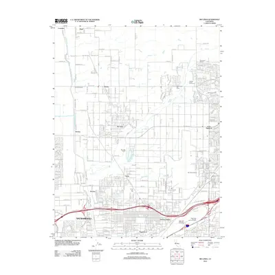
2012 Map of Rio Linda
USGS Topo · Published 2012About this map
The community of Rio Linda and the northern reaches of Sacramento are defined by a grid of rural residential lots and significant aviation infrastructure. The landscape is characterized by the convergence of several waterways, including Steelhead Cr, Dry Cr, and Arcade Cr, which thread through the expanding suburban developments of North Highlands and Del Paso Heights. Aviation history is prominent here, with the large expanse of Mc Clellan Airfield dominating the eastern sector, complemented by smaller local strips like Rio Linda Airport and Holtsmans Airport.
Find a feature on this map
282 named features on this map. Tap any name to fly to it.
Don’t see what you’re looking for? This feature index may not catch every label — zoom into the map to look around manually.
Map Details
Editions of this 2012 Rio Linda Map
This is the sole edition of this map. No revisions or reprints were ever made.
Other maps of this area

1891 · Sacramento
USGS Topo · 1:125,000

1892 · Sacramento
USGS Topo · 1:125,000

1893 · Sacramento
USGS Topo · 1:125,000

1902 · Fairoaks
USGS Topo · 1:62,500

1907 · Davisville
USGS Topo · 1:62,500

1910 · Roseville
USGS Topo · 1:31,680

1910 · Vernon
USGS Topo · 1:31,680

1910 · Pleasant Grove
USGS Topo · 1:31,680

1911 · Brighton
USGS Topo · 1:31,680

1911 · Mills
USGS Topo · 1:31,680