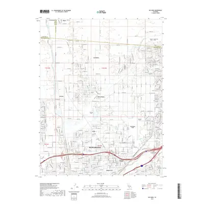
2018 Map of Rio Linda
USGS Topo · Published 2018About this map
The northern reaches of Sacramento meet the agricultural and suburban transitions of the Central Valley in this detailed 2018 survey. The landscape is defined by its aviation and transit infrastructure, featuring both the Rio Linda Airport and the expansive McClellan Airfield at McClellan Park. Residential neighborhoods such as Del Paso Heights, Hagginwood, and Robla are shown in fine detail, alongside the community of Rio Linda and the more northern settlement of Elverta. The map captures the convergence of natural waterways like Steelhead Cr and Dry Cr with the grid of major thoroughfares and interstate connectors. Local history is anchored by landmarks like Sunset Lawn Cemetery and educational institutions including the Kaplan College Sacramento Campus. To the north, the terrain becomes more rural near the Sutter County and Placer County lines, where small locales like Counsman and Riego represent the area's agricultural fringe.
Find a feature on this map
160 named features on this map. Tap any name to fly to it.
Don’t see what you’re looking for? This feature index may not catch every label — zoom into the map to look around manually.
Map Details
Editions of this 2018 Rio Linda Map
This is the sole edition of this map. No revisions or reprints were ever made.
Other maps of this area

1891 · Sacramento
USGS Topo · 1:125,000

1892 · Sacramento
USGS Topo · 1:125,000

1893 · Sacramento
USGS Topo · 1:125,000

1902 · Fairoaks
USGS Topo · 1:62,500

1907 · Davisville
USGS Topo · 1:62,500

1910 · Roseville
USGS Topo · 1:31,680

1910 · Vernon
USGS Topo · 1:31,680

1910 · Pleasant Grove
USGS Topo · 1:31,680

1911 · Brighton
USGS Topo · 1:31,680

1911 · Mills
USGS Topo · 1:31,680