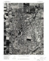
1975 Map of Rio Linda
USGS Topo · Published 1978About this map
Rio Linda and the surrounding Sacramento Valley are captured in this mid-1970s orthophotograph, providing a rare hybrid view of agricultural patterns meeting suburban expansion. The dominance of McClellan Air Force Base is clear in the eastern portion of the sheet, with its expansive runways and industrial infrastructure anchoring the local economy. This aerial perspective, prepared from high-altitude photographs taken in 1975, reveals the precise grain of the land—from the dense street grids of North Highlands and Del Paso Heights to the larger rural parcels and creek drainages that still characterized much of the northern Sacramento area at the time. Researchers can observe the transition between the established city limits and the developing residential tracts that would soon define the region's modern footprint.
Find a feature on this map
5 named features on this map. Tap any name to fly to it.
Don’t see what you’re looking for? This feature index may not catch every label — zoom into the map to look around manually.
Map Details
Editions of this 1975 Rio Linda Map
This is the sole edition of this map. No revisions or reprints were ever made.
Other maps of this area

1891 · Sacramento
USGS Topo · 1:125,000

1892 · Sacramento
USGS Topo · 1:125,000

1893 · Sacramento
USGS Topo · 1:125,000

1902 · Fairoaks
USGS Topo · 1:62,500

1907 · Davisville
USGS Topo · 1:62,500

1910 · Roseville
USGS Topo · 1:31,680

1910 · Vernon
USGS Topo · 1:31,680

1910 · Pleasant Grove
USGS Topo · 1:31,680

1911 · Brighton
USGS Topo · 1:31,680

1911 · Mills
USGS Topo · 1:31,680