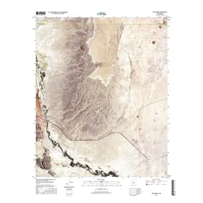
2017 Map of Rio Puerco
USGS Topo · Published 2017About this map
Rio Puerco flows south through this arid landscape, defining the character of the borderlands between Bernalillo Co and Valencia Co. The topography is dominated by dramatic elevations such as Cat Mesa in the north and the prominent Hidden Mtn in the southwest, separated by the wide drainage basins of the river and its tributaries like Arroyo Garcia.
Find a feature on this map
19 named features on this map. Tap any name to fly to it.
Don’t see what you’re looking for? This feature index may not catch every label — zoom into the map to look around manually.
Map Details
Editions of this 2017 Rio Puerco Map
This is the sole edition of this map. No revisions or reprints were ever made.
Other maps of this area

1917 · Cerro Verde
USGS Topo · 1:125,000

1952 · Wind Mesa
USGS Topo · 1:24,000

1952 · Dalies
USGS Topo · 1:24,000

1952 · Belen
USGS Topo · 1:24,000

1952 · Belen NW
USGS Topo · 1:24,000

1952 · Rio Puerco
USGS Topo · 1:24,000

1952 · Dalies NW
USGS Topo · 1:24,000

1954 · South Garcia
USGS Topo · 1:24,000

1954 · South Garcia SE
USGS Topo · 1:24,000

1954 · Socorro
USGS Topo · 1:250,000