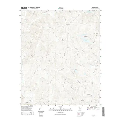
2014 Map of Rion
USGS Topo · Published 2014About this map
Rion anchors the eastern edge of this Fairfield County landscape, a region defined by its complex network of creek drainage and family heritage sites. The terrain is deeply etched by waterways like the Little River, Jackson Cr, and Morris Cr, which feed into the Winnsboro Reservoir. Numerous family and community burial grounds, including Gladney Cem, Milling Crossroad Cem, and the Molly Alston Cem, are scattered throughout the wooded hills, offering valuable spatial data for genealogists tracing local lineage. The road network, featuring names like Old Hillcrest School Rd and Kincaid Bridge Rd, suggests a long-established rural infrastructure. In the south, Glenns Bridge provides a key crossing over the Little River, while the northern reaches show watershed management via Jackson Mill Creek Watershed Structure Number Two.
Find a feature on this map
65 named features on this map. Tap any name to fly to it.
Don’t see what you’re looking for? This feature index may not catch every label — zoom into the map to look around manually.
Map Details
Editions of this 2014 Rion Map
This is the sole edition of this map. No revisions or reprints were ever made.
Other maps of this area

1904 · Columbia
USGS Topo · 1:125,000

1941 · Spartanburg
USGS Topo · 1:250,000

1947 · Richtex
USGS Topo · 1:24,000

1949 · Richtex
USGS Topo · 1:24,000

1949 · Irmo NE
USGS Topo · 1:24,000

1953 · Spartanburg
USGS Topo · 1:250,000

1960 · Spartanburg
USGS Topo · 1:250,000

1963 · Spartanburg
USGS Topo · 1:250,000

1964 · Spartanburg
USGS Topo · 1:250,000

1969 · Lebanon
USGS Topo · 1:24,000