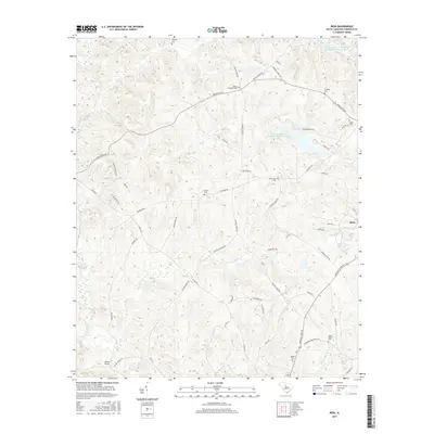
2017 Map of Rion
USGS Topo · Published 2017About this map
The settlement of Rion occupies the eastern portion of this Fairfield County landscape, situated near a complex network of creeks and small family-named cemeteries. Tributaries like Morris Cr, Mill Cr, and Robinson Br drain the terrain toward the Little River, which snakes through the western edge of the area. This mid-2010s survey reveals a landscape defined by water management and rural interment, featuring significant infrastructure such as the Winnsboro Reservoir and the Jackson Mill Creek Watershed Structure Number One. Genealogists will find a high density of burial sites including Molly Alston Cem, Bethel Cem, and Shiloh Cem, which reflect the long-standing community roots in the region. Transportation follows established corridors such as Hinnants Store Rd and Kincaid Bridge Rd, connecting the scattered homesteads and timberlands to local hubs like Glenns Bridge.
Find a feature on this map
60 named features on this map. Tap any name to fly to it.
Don’t see what you’re looking for? This feature index may not catch every label — zoom into the map to look around manually.
Map Details
Editions of this 2017 Rion Map
This is the sole edition of this map. No revisions or reprints were ever made.
Other maps of this area

1904 · Columbia
USGS Topo · 1:125,000

1941 · Spartanburg
USGS Topo · 1:250,000

1947 · Richtex
USGS Topo · 1:24,000

1949 · Richtex
USGS Topo · 1:24,000

1949 · Irmo NE
USGS Topo · 1:24,000

1953 · Spartanburg
USGS Topo · 1:250,000

1960 · Spartanburg
USGS Topo · 1:250,000

1963 · Spartanburg
USGS Topo · 1:250,000

1964 · Spartanburg
USGS Topo · 1:250,000

1969 · Lebanon
USGS Topo · 1:24,000